 |
| From 20090829 將軍石 |
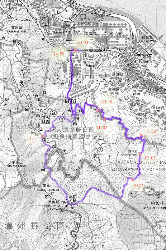
Date: 2009/08/29
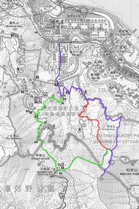
Route: 太古 --> 鰂魚涌郊野公園 --> 將軍石 --> 柏架山
Length: ~ 5km
Time: 09:30 - 14:10 (exact times shown on map)
Temp: 炎熱 ( > 30 C)
Difficulty: Difficult
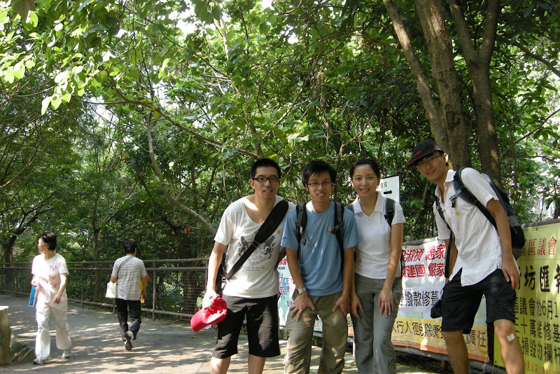
Well... 是次「男女當行山 official 處女行」飛機率甚高... 幸得葉氏一家支持,總算沒有爛尾,令小弟感動 T_T ~~
Anyway 這次少一點人也好,皆因路線比想像中難,而且天熱酷熱,以「處女 function」 而言的確不太適合...
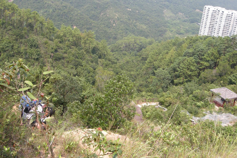
這次挑戰的是位於鰂魚涌郊野公園、柏架山下的將軍石 (as far as I know, there are more than one 將軍石s...),出發沿衞奕信徑二段行,轉上康柏郊遊徑,很快便到達前 post website 所說的涼亭了...
這處亦是小弟被 fake 得最厲害的地方,就是花了整整 40 分鐘去找 website 所說的「 過了涼亭後見一路不通行的指示牌」--- 小弟在涼亭附近不斷尋找小徑,當中不乏一些危險動作,例如:
這裡稍一不抓緊,星期日就見報了... 小朋友切記不要模彷...
「正途」其實在康柏郊遊徑標距柱 C4305 過一點點的小路(並沒有「路不通行」牌 lor...),入口非常明顯,路旁是鐵絲網,路上還有一點藍點指引... 大家留意了.
過了一會就落一個斜坡落引水道,講真句,I don't think its necessary 因為看地圖應該直行都 ok... But anyway 因為我信個 website... 所以照落吧。不過落去都好,有清涼山水作獎勵 ~
這護士牆都 ok 斜... 鏡頭是側了小小,但實情都係斜,要拿著繩子落.
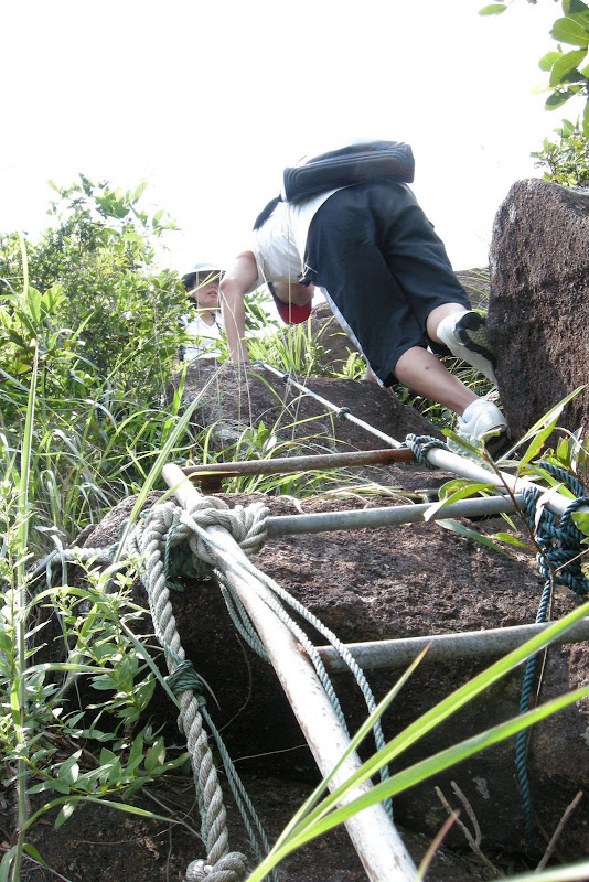
之後沿著這磈木板過引水道上,就是真挑戰的開始了... 打後一小時,基本上大部份時間都要「四腳爬爬」...
看來繩索不夠用,有人竟想到用 Lan 線 + AV 線做繩索...
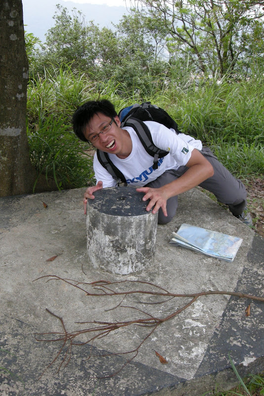
這是傳說中的 "Pat Pat 石",等我地摸下先 ~~
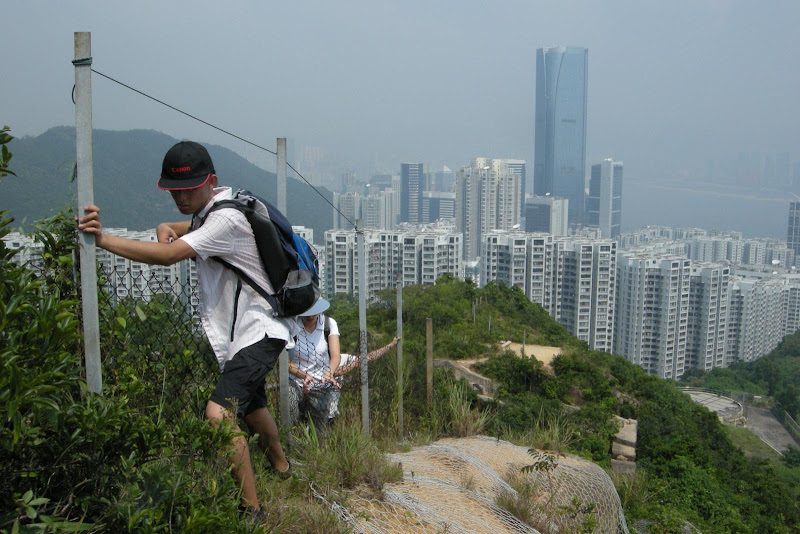
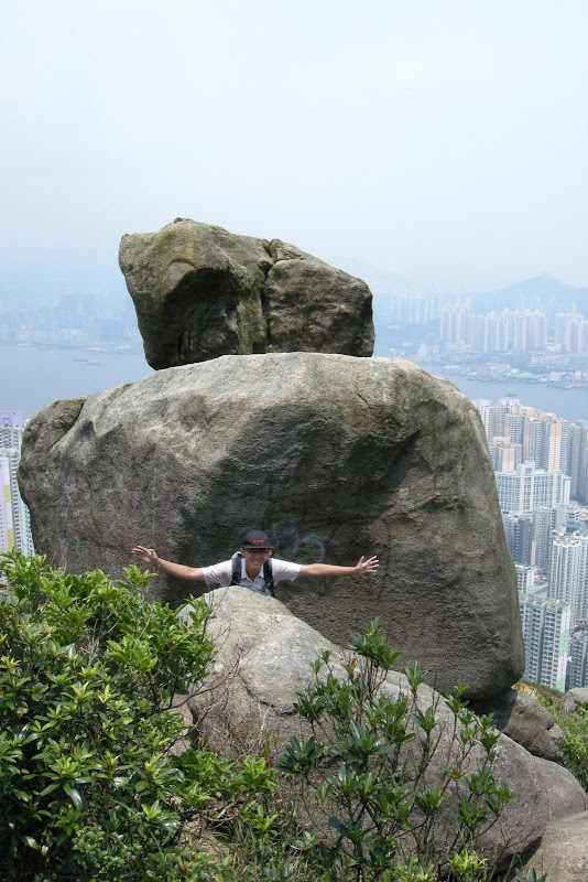
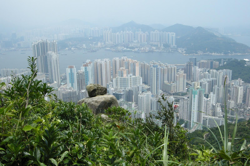
真正主角就是這個將軍石,佢都 ok 大份的,遠遠處都望到它 ~
將軍虎瞰筲箕灣、鯉魚門、油塘至將軍澳一帶
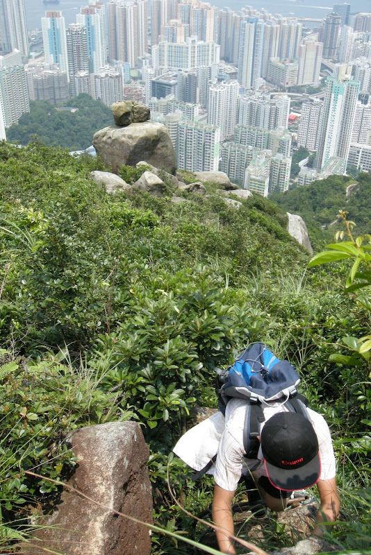
將軍石附近的路段極度費力難行,大家起勢爬... and 小心草木界手...
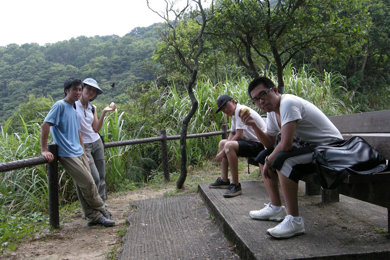
終於到頂了... 大家吃個「慰勞梨」先 ~~
由於大家水源耗盡,所以都急急下山... 一小時便回到山腳,立刻衝入 7-11 買飲品... 旅程圓滿結束 ~~
Well... 是次「男女當行山 official 處女行」飛機率甚高... 幸得葉氏一家支持,總算沒有爛尾,令小弟感動 T_T ~~
Anyway 這次少一點人也好,皆因路線比想像中難,而且天熱酷熱,以「處女 function」 而言的確不太適合...
 |
| From 20090829 將軍石 |
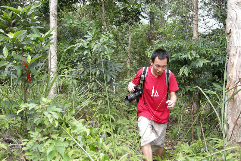
這次挑戰的是位於鰂魚涌郊野公園、柏架山下的將軍石 (as far as I know, there are more than one 將軍石s...),出發沿衞奕信徑二段行,轉上康柏郊遊徑,很快便到達前 post website 所說的涼亭了...
 |
| From 20090829 將軍石 |
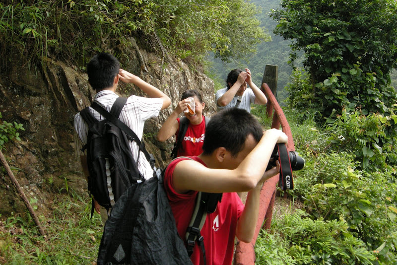
這處亦是小弟被 fake 得最厲害的地方,就是花了整整 40 分鐘去找 website 所說的「 過了涼亭後見一路不通行的指示牌」--- 小弟在涼亭附近不斷尋找小徑,當中不乏一些危險動作,例如:
 |
| From 20090829 將軍石 |
這裡稍一不抓緊,星期日就見報了... 小朋友切記不要模彷...
 |
| From 20090829 將軍石 |
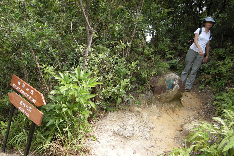
「正途」其實在康柏郊遊徑標距柱 C4305 過一點點的小路(並沒有「路不通行」牌 lor...),入口非常明顯,路旁是鐵絲網,路上還有一點藍點指引... 大家留意了.
 |
| From 20090829 將軍石 |
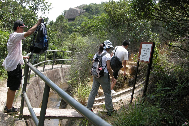
過了一會就落一個斜坡落引水道,講真句,I don't think its necessary 因為看地圖應該直行都 ok... But anyway 因為我信個 website... 所以照落吧。不過落去都好,有清涼山水作獎勵 ~
 |
| From 20090829 將軍石 |
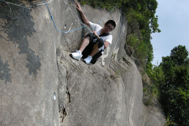
這護士牆都 ok 斜... 鏡頭是側了小小,但實情都係斜,要拿著繩子落.
 |
| From 20090829 將軍石 |
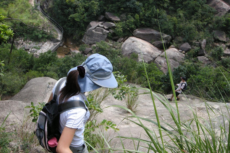
之後沿著這磈木板過引水道上,就是真挑戰的開始了... 打後一小時,基本上大部份時間都要「四腳爬爬」...
 |
| From 20090829 將軍石 |
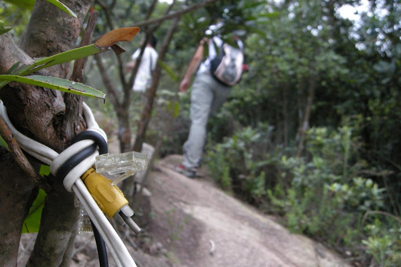
看來繩索不夠用,有人竟想到用 Lan 線 + AV 線做繩索...
 |
| From 20090829 將軍石 |
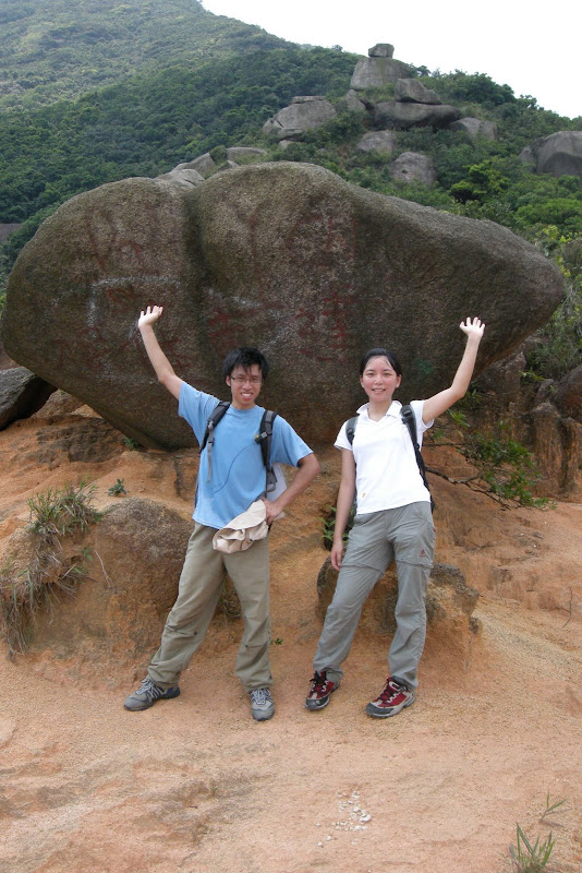
這是傳說中的 "Pat Pat 石",等我地摸下先 ~~
 |
| From 20090829 將軍石 |
真正主角就是這個將軍石,佢都 ok 大份的,遠遠處都望到它 ~
 |
| From 20090829 將軍石 |
將軍虎瞰筲箕灣、鯉魚門、油塘至將軍澳一帶
 |
| From 20090829 將軍石 |
 |
| From 20090829 將軍石 |
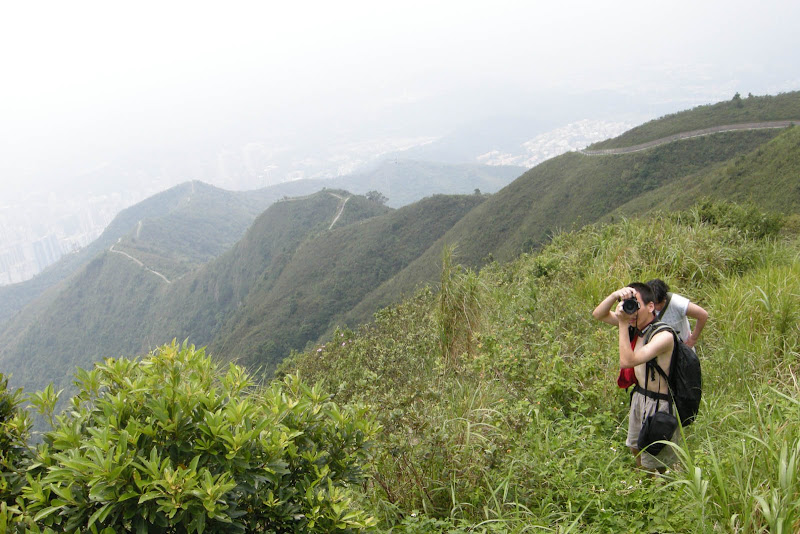
將軍石附近的路段極度費力難行,大家起勢爬... and 小心草木界手...
 |
| From 20090829 將軍石 |
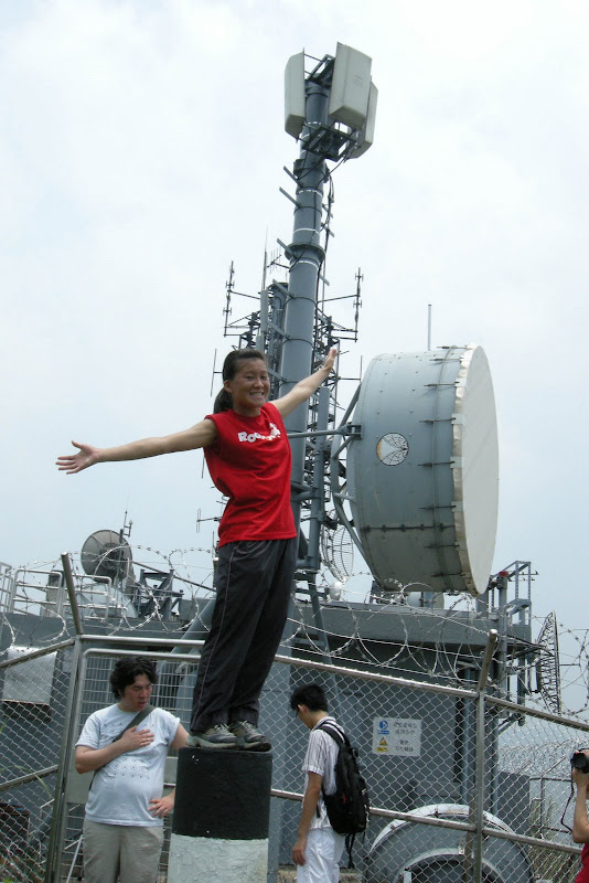
終於到頂了... 大家吃個「慰勞梨」先 ~~
由於大家水源耗盡,所以都急急下山... 一小時便回到山腳,立刻衝入 7-11 買飲品... 旅程圓滿結束 ~~